Show summary Hide summary
After a weekend of unusually warm temperatures that shattered March records across parts of southeastern Wyoming and western Nebraska, forecasters say an even stronger surge of heat is expected to arrive midweek — followed by a sharp cooldown. The National Weather Service in Cheyenne warns the peak will likely come Wednesday afternoon, raising concerns about strong winds, elevated fire danger and abrupt temperature swings.
Saturday’s warmth was historic: multiple stations logged their highest March readings on record, with Cheyenne topping out in the low 80s and other nearby sites reaching the 90s. That event set up a building ridge of high pressure that meteorologists say will push daytime highs back into the 80s and 90s by midweek, before a cold front knocks temperatures down dramatically Thursday night into Friday.
Why this matters now
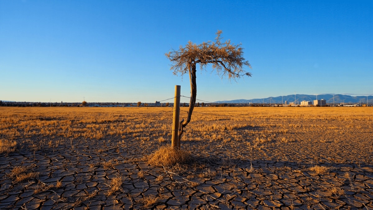
The rapid flip from warm to cold matters because it combines three risks at once: record-level heat for this time of year, gusty winds that can exceed 50–60 mph in favored corridors, and low humidity that amplifies wildfire potential. For residents, that means outdoor plans, vulnerable crops and any ongoing prescribed burns could be affected over the next 72 hours.
Disaster drills cut casualties after major quake struck southern Philippines
Horoscope today: major love and money shifts for June 2, 2026
The forecast includes a brief window of cooler, more typical spring weather today, and a chance for isolated rain or mountain snow in higher terrain. But models converge on a midweek peak before the front arrives late Wednesday and brings a 20–30 degree drop in many locations by Thursday.
Forecast snapshot (Cheyenne area)
- Today: Mostly cloudy with highs near the upper 60s; a few isolated showers possible this afternoon along I‑80. Light to moderate westerly winds.
- Tonight: Skies remain mostly cloudy with lows around the low 40s and lighter winds.
- Tuesday: Drier but breezy, highs climbing into the mid‑70s; lower elevations may hit 80. Winds increase through the day, with gusts approaching 35–45 mph in some spots.
- Wednesday: Warmest day — sunny skies and highs in the 80s to near 90. Windy conditions persist; gusts could reach 60+ mph in favored passes and ridgelines.
- Late Wednesday night – Thursday: A cold front arrives, dropping temperatures by roughly 20–30 degrees and bringing a slight chance of afternoon/evening showers. Blustery and much cooler on Thursday.
- End of week: Cooler, more seasonable conditions Friday into the weekend with temperatures rebounding modestly by Sunday.
Key impacts and outlook
Forecast guidance emphasizes three practical impacts over the coming days:
- Wind hazard: Top gusts are likely in corridors such as I‑80 and along exposed ridgelines; travel could be difficult for high-profile vehicles.
- Fire weather: Lower humidity and strong west winds Tuesday–Wednesday will raise the risk for rapid fire spread where fuels are dry.
- Rapid temperature swing: The abrupt drop after the front increases stress on sensitive vegetation and can complicate springtime outdoor work and events.
Higher elevations (above roughly 9,000 feet) may see light snow with minimal accumulations, while most valleys will experience the pronounced warm-to-cool transition without significant precipitation.
All timings and magnitudes remain subject to change as the system evolves. The National Weather Service in Cheyenne is the primary source for updated warnings and watches through midweek.