Show summary Hide summary
Southeast Wyoming faces a brief but intense stretch of heat and critical fire weather through Tuesday, with the National Weather Service in Cheyenne warning conditions could allow any ignition to spread rapidly. A sharp pattern change is expected later in the week as a Pacific system brings high winds, rain and a late-season switch to snow.
The NWS has issued a Red Flag Warning for areas east of the Laramie Range through 8 p.m. Tuesday. Forecasts call for west to northwest winds up to about 30 mph and relative humidity falling into the single digits — a combination that can turn small fires into fast-moving incidents.
Forecast through the weekend
Temperatures will climb Tuesday as a ridge of high pressure builds. Cheyenne is likely to reach the mid-to-upper 70s — roughly two dozen degrees above typical April values — while portions of the High Plains could approach the upper 80s, flirting with April records.
Pittsburgh fireworks guide: find the best viewing sites and legal ignition zones for July 4
Delivery impersonator shoots through package at ex’s new boyfriend
Although skies are expected to remain mostly sunny, forecasters note a chance of late-afternoon, gusty showers on Tuesday. Much of that precipitation may evaporate before reaching the ground, producing virga in many locations and doing little to reduce the ongoing dryness.
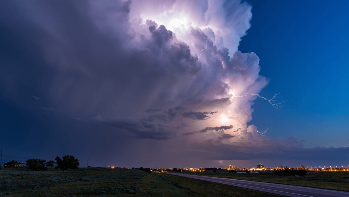
By Wednesday the atmosphere becomes more unsettled as energy arrives from the Pacific Northwest. Strong west-southwest winds could develop, with pockets of Cheyenne seeing gusts to 50 mph. Humidity is expected to stay low, so the elevated fire threat will not subside immediately. The Nebraska Panhandle should monitor for severe storms and the possibility of dry lightning, which can spark new fires far from rainfall.
A cold front will sweep through Thursday night, ushering in a rapid cooldown and a changeover from rain to snow. Friday and Saturday are likely to bring measurable snowfall for parts of the region and daytime highs that struggle to climb above the 40s. The unsettled pattern — with a mix of rain, snow and isolated t-storms in the higher terrain — is expected to persist into Sunday.
What this means for residents
Given the forecast, local impacts are clear: outdoor burning and other fire-prone activities are especially risky through Tuesday; high winds midweek could damage unsecured objects and reduce visibility on exposed roadways; and travel may become hazardous late in the week when wet roads turn to snow or ice.
- Today–Tuesday: Very dry, warm to hot for April, with strong westerly winds at times. Expect rapid fire spread where fires occur.
- Wednesday: Increasing windiness and instability. Low humidity persists; severe storms possible across the Panhandle.
- Thursday night–Saturday: Cooling trend with precipitation changing to snow. Periods of travel-impacting snow likely in places.
- Sunday: Continued unsettled conditions with scattered rain or snow and isolated thunderstorms in the mountains.
Stay tuned to the National Weather Service in Cheyenne for real-time updates, watches and warnings as the situation evolves. Local emergency managers will post any restrictions or advisories if conditions warrant.