Show summary Hide summary
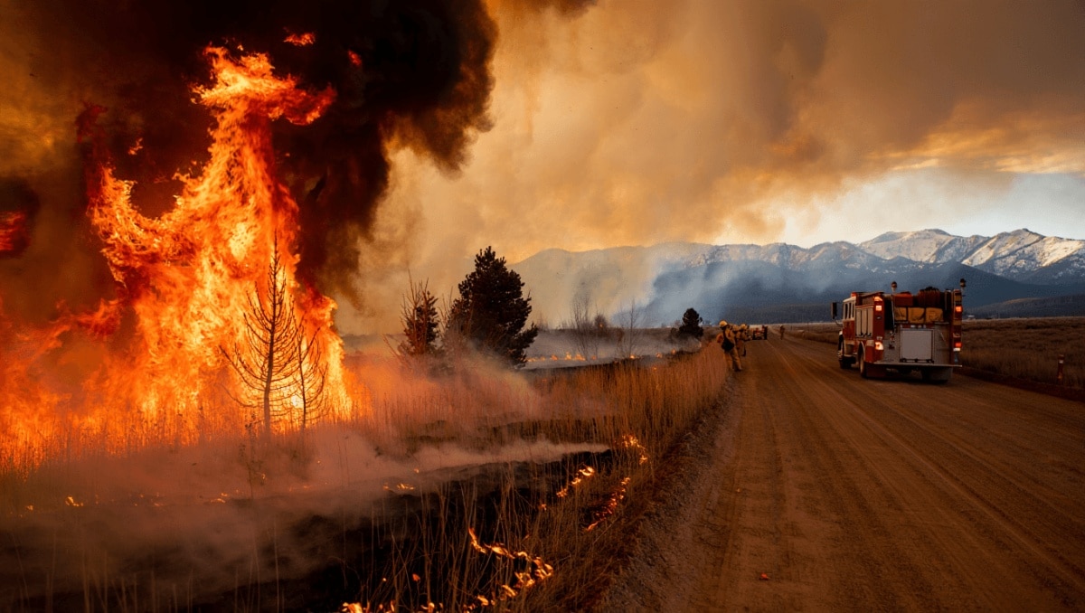
A surge of high pressure over the Rockies will lift temperatures across southeast Wyoming this weekend, but forecasters warn the opposite — gusty winds and sharply reduced humidity — raises the immediate risk of fast-moving fires. The National Weather Service in Cheyenne says residents should treat outdoor flames with extreme caution as conditions become markedly drier into early next week.
The NWS has issued a red flag warning covering Laramie County and much of the Nebraska Panhandle from late morning through this evening. Winds from the west to northwest are forecast to gust into the mid‑20s and low‑30s (mph), while relative humidity could fall to around 12% in some areas — a combination that fuels rapid fire spread.
What’s driving the change
A pronounced ridge of high pressure is moving in from the west, displacing colder air that held temperatures below normal for mid‑April. That pattern brings clearer skies and rising daytime readings: Cheyenne is expected to climb from the low 50s today into the mid‑60s on Sunday and the 70s by Monday and Tuesday.
Disaster drills cut casualties after major quake struck southern Philippines
Horoscope today: major love and money shifts for June 2, 2026
Even as temperatures warm, the atmosphere will remain unusually dry. Overnight moisture levels are expected to dip to the single digits at times, prompting the NWS to post a fire weather watch from Sunday morning through Monday evening.
Forecast snapshot (Cheyenne area)
- Today: Sunny, high near 51°F. Northwest winds 15–20 mph with gusts up to about 30 mph.
- Tonight: Partly cloudy, low near 27°F. Winds blustery early, easing after midnight.
- Sunday: Becoming mostly sunny, high near 65°F. Lighter west‑northwest breeze 5–15 mph.
- Sunday night: Mostly clear, low around 35°F. Winds shift to the southwest after midnight.
- Monday: Mostly sunny and warmer, high around 74°F. West‑northwest gusts return in the afternoon.
- Tuesday: Sunny and mild, high near 76°F.
- Wednesday: Mostly sunny with a slight chance of afternoon showers; breezy, high near 76°F.
- Thursday: A cold front arrives — cooler with a chance of rain and mountain snow, high falling toward the low 60s.
- Late week: Chance for lingering rain or snow showers into Friday; temperatures trend lower behind the front.
These numbers reflect the broad trend: warmer days under dry, windy conditions until the late‑week front alters the pattern. The arrival of that front brings the earliest realistic chance for meaningful precipitation across the region.
Local impact and advice
According to the NWS, any fire that starts while winds are strong and humidity is low is likely to spread quickly and become difficult to control. With gusts returning Monday and very dry overnight conditions expected, outdoor burning is strongly discouraged through Monday evening.
Practical steps residents can take include removing flammable debris from around structures, keeping heavy equipment free of exhaust sparks, and avoiding recreational fires while warnings are in effect. Local fire agencies remain the best source for area‑specific restrictions and updates.
Forecasts can change; for the latest watches and warnings see the National Weather Service in Cheyenne for real‑time updates and safety guidance.