Show summary Hide summary
A surge of unseasonably warm air is set to push southeast Wyoming into the 80s and low 90s Wednesday, nearly 10 degrees above typical March readings, prompting the National Weather Service in Cheyenne to issue a red flag warning for Laramie County and temporary travel limits on Interstate 80. The rapid warming, combined with strong winds and very low humidity, raises immediate wildfire and travel concerns across the region.
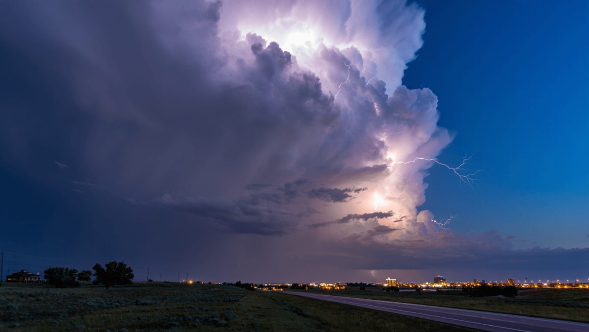
Temperatures already climbing into the 70s today will continue upward, with meteorologists pointing to Wednesday as the day with the highest risk for record highs and hazardous fire conditions. Gusts capable of reaching 40–45 mph and relative humidity near 10% are creating an environment where flames could spread quickly if ignited.
Authorities have restricted light, high‑profile vehicles along the stretch of I‑80 between Buford and Cheyenne because of the strong crosswinds. The National Weather Service also flagged a small but meaningful chance — about 10% — of dry lightning from isolated afternoon showers on Wednesday, a scenario that can start blazes in tinder‑dry grasslands.
Pittsburgh fireworks guide: find the best viewing sites and legal ignition zones for July 4
Delivery impersonator shoots through package at ex’s new boyfriend
How long this lasts and what follows
The intense warmth is short‑lived. Forecast models point to a strong cold front arriving Thursday morning that should knock temperatures down by roughly 20 degrees and bring a mix of rain and snow to the county. That shift will ease the immediate fire danger but could produce blustery, wintry conditions and slick roads for a time.
Impacts to watch: wildfire ignition and rapid spread, gusty travel conditions across mountain passes and I‑80, and a sharp temperature swing from summerlike to near‑winter in less than 48 hours.
Forecast snapshot
- Today: Mostly sunny, high near the mid‑70s. West‑northwest winds 10–20 mph, increasing to 20–30 mph; gusts up to 40 mph.
- Tonight: Mostly clear, low around 51. Breezy with diminishing west winds and gusts near 30 mph early.
- Wednesday: Highest day of the warmup — highs in the low 80s regionwide, 80s to low 90s along I‑25. A slight (about 20%) chance of afternoon showers with isolated lightning. West winds 10–20 mph, gusting to 30‑45 mph.
- Wednesday night: Mostly clear, low near 49. Winds easing overnight.
- Thursday: Turning cooler — high near the mid‑60s with increasing clouds and a chance of showers after noon. Winds shift to the north and become gusty.
- Thursday night: Rain transitioning to snow after evening, temperatures dropping to around 27. Blustery with a 30% chance of precipitation.
- Friday through Monday: Temperatures moderate into the upper 40s to low 70s on different days with intermittent chances for showers over the weekend.
Officials and residents should monitor forecasts closely over the next 48 hours. For the latest watches, warnings and hourly updates, consult the National Weather Service in Cheyenne.