Show summary Hide summary
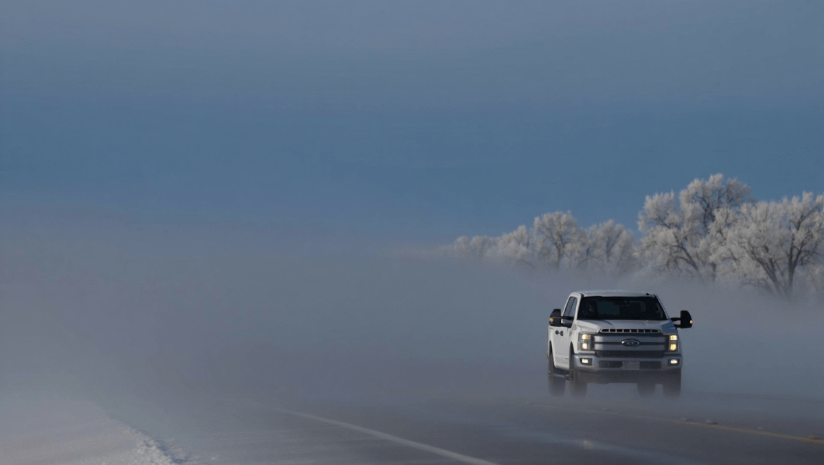
Dense fog this morning has sharply reduced visibility across central Laramie County, creating hazardous driving conditions on Interstate 80. The fog is expected to lift by mid‑morning, but a late‑day weather pattern will raise the risk of strong to severe thunderstorms through the weekend—bringing potential damaging winds and large hail to parts of southeastern Wyoming.
The National Weather Service in Cheyenne issued a dense fog advisory through 9 a.m., reporting visibility under a quarter mile in spots. Motorists should expect slow-moving traffic and pockets of near‑zero visibility until the sun helps mix out low clouds.
Once the fog clears, temperatures will climb into the mid‑ to upper‑70s. Storm chances rise to roughly 40% after noon, with meteorologists warning that some cells could rapidly collapse and produce powerful downdrafts—commonly called microbursts—and large hail, particularly closer to the Nebraska border. Overnight, the severe threat diminishes but a 20% chance of showers remains as lows fall near 50.
Oʻahu 800 bikes unaccounted for: sudden shortfall strands commuters
Sleep quality vs hours: why quantity alone may leave you tired
Saturday looks cooler and breezier, with scattered afternoon storms possible and peak gusts increasing into the 25–30 mph range. By Sunday the main system shifts north, bringing drier air but continued brisk winds; gusts could reach as high as 35 mph Sunday afternoon.
A gradual warming trend begins next week. Highs should move from the low 70s Monday to around 80 by Thursday, with only isolated afternoon shower chances most days.
What this means for you
Weather timing and intensity matter for travel, outdoor events and agriculture. Heavy downpours or a microburst can cause sudden visibility loss and downed branches, while hail can damage vehicles and crops. Keep an eye on later forecasts if you have plans outdoors Saturday evening into Sunday.
- Travel: Expect slow speeds on I‑80 while the fog persists; allow extra time and use low beams.
- Outdoors: Postpone or prepare shelters for evening events when storms are possible.
- Property: Secure loose outdoor items ahead of gusty winds.
- Stay informed: Watch local NWS updates and storm warnings if thunderstorms develop.
Detailed forecast
| Period | Chance & timing | Temps | Winds / notes |
|---|---|---|---|
| Today | 40% — mainly after noon | High near 77°F | Patchy fog early; SSE 5–15 mph |
| Tonight | 20% — late evening | Low around 50°F | Becoming mostly clear; light NNW wind |
| Saturday | 30% — afternoon into evening | High near 70°F | W 10–15 mph, gusts to 25 mph |
| Saturday night | Showers/weak storms possible | Low around 49°F | Breezy; gusts up to 30 mph |
| Sunday | 20% — afternoon | High near 71°F | W 15–20 mph, gusts to 35 mph |
| Next week (Mon–Thu) | Isolated afternoon chances | 72°F → 80°F by Thu | Mostly dry trend, breezy at times |
Forecasters at the NWS Cheyenne will post updates if storm tracks or intensity change; those with travel or outdoor plans for Saturday evening should monitor warnings through the afternoon.