Show summary Hide summary
This morning drivers in southeast Wyoming should expect pockets of thick fog that will reduce visibility on major routes, followed by a stretch of unsettled weather with daily chances for showers and thunderstorms through next week. That shift matters for commuters, outdoor plans and any activity that depends on reliable travel or lightning-safe conditions.
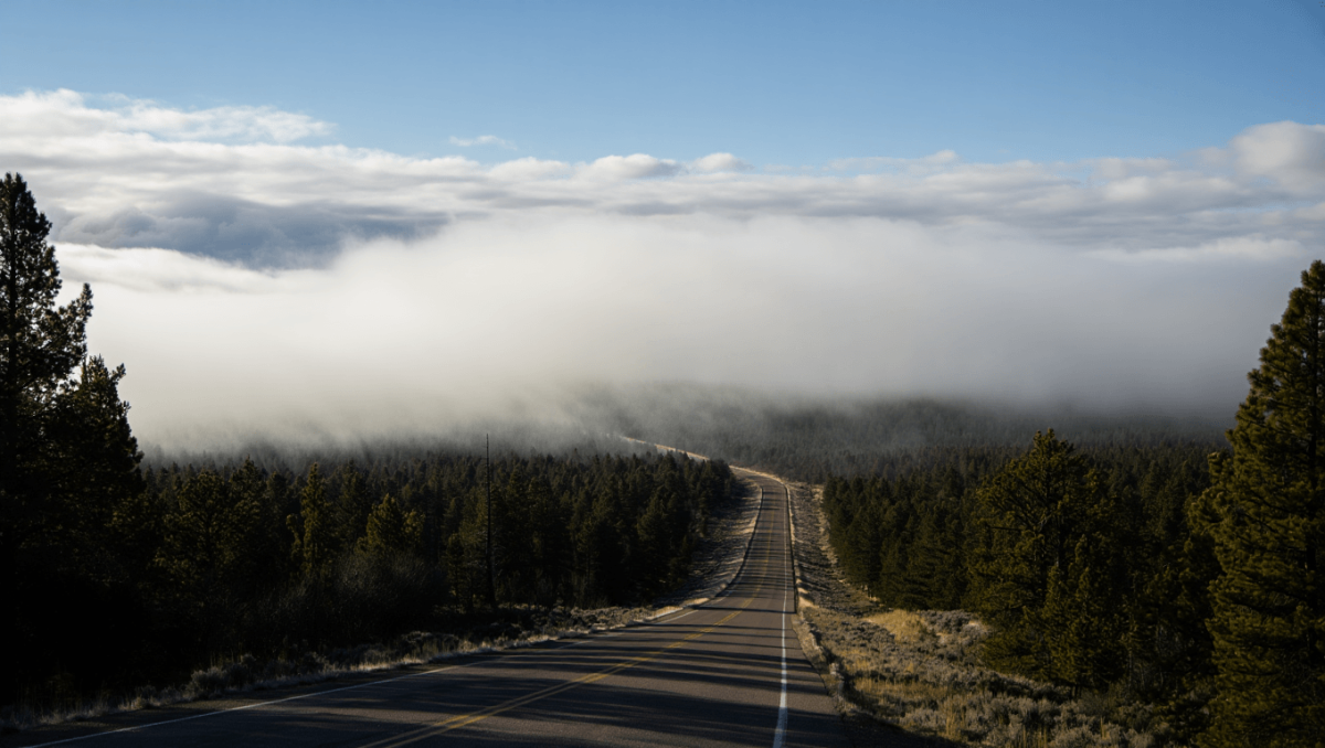
Dense fog and travel impacts
The National Weather Service in Cheyenne has placed parts of central Laramie County and the South Laramie Range under a dense fog advisory for the early morning hours. Motorists reported visibility dropping to less than a quarter-mile in spots along I‑80 and I‑25 down toward the Colorado line.
Expect slow-moving traffic where fog is heaviest. Drive-safety measures — reduced speed, low beams and extra following distance — will be important until conditions improve. The advisory is expected to expire this morning as the sun and light winds help mix the air.
Pittsburgh fireworks guide: find the best viewing sites and legal ignition zones for July 4
Delivery impersonator shoots through package at ex’s new boyfriend
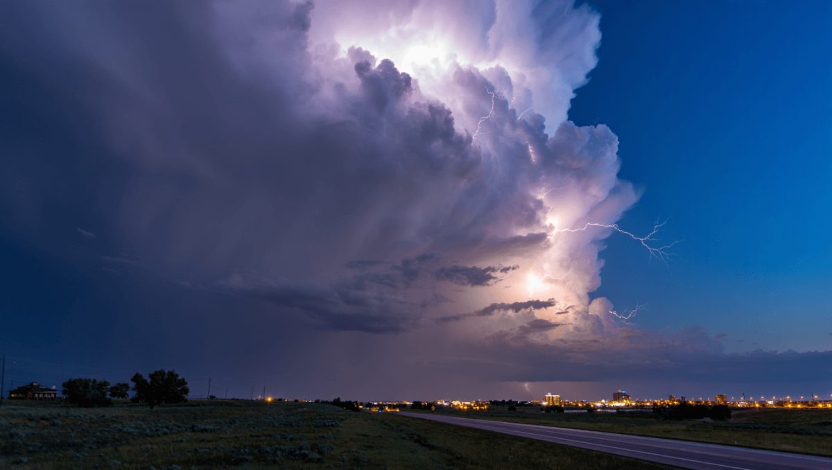
Storm chances increase later this week
A broad upper-level low rotating across the Rockies will keep the region in a persistently unstable pattern. Afternoon and evening showers and thunderstorms are likely through at least Wednesday, with the greatest concentration of activity in the afternoons.
Forecasters say Friday presents the most notable uptick in severe-weather potential this week: model guidance shows roughly a 40% chance of storms after midafternoon, and far-southeast Wyoming into western Nebraska has been assigned a marginal, Level 1 severe-weather threat.
Storms that form could bring intense, brief downdrafts known as wet microbursts, along with frequent lightning, gusty winds, isolated hail and locally heavy rainfall. While widespread severe events are not expected, isolated strong storms are possible and could briefly impair travel and outdoor activities.
Temperatures and timing
Despite the rain threat, daytime highs should remain mild — generally in the 70s and low 80s — with overnight lows dipping into the upper 40s to low 50s. The active pattern is forecast to persist through midweek as the upper low slowly migrates.
- Who is affected: Commuters on I‑80 and I‑25, outdoor workers, event planners and anyone traveling into far-southeast Wyoming or western Nebraska.
- Main hazards: Reduced visibility in morning fog; lightning, gusty winds, isolated hail, and heavy downpours during afternoon/evening storms.
- Why it matters now: The combination of morning fog and later-day storms raises the chance of multi-period travel disruptions during the next several days.
Day-by-day snapshot
| Day | Expected conditions | Temp (High / Low) | Precip chance |
|---|---|---|---|
| Today (Thu) | Patchy dense fog early, then mostly cloudy with a few afternoon showers possible | Near 70 / ~52 | Low to moderate |
| Friday | Cloudy to partly sunny; showers and storms mainly after 3 p.m.; isolated strong cells possible | ~75 / ~51 | About 40% |
| Saturday–Sunday | Daily chances for afternoon storms; breaks of sun expected between rounds | Low 70s / upper 40s–low 50s | Around 30–40% |
| Monday–Wednesday | Continued afternoon shower and thunderstorm risk as upper-level low lingers | Mid 70s / mid-to-upper 40s | Ongoing chance each afternoon |
Keep an eye on updated forecasts from the National Weather Service in Cheyenne and plan travel with the possibility of reduced visibility and storm-related delays in mind.