Show summary Hide summary
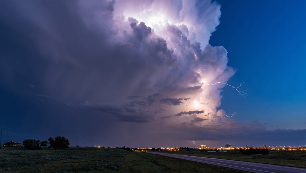
Cheyenne and much of southeast Wyoming should prepare for a stretch of unsettled weather beginning this afternoon, with daily chances for showers and thunderstorms through the weekend. The shift matters for anyone with outdoor plans or highway travel along Interstate 80, as some storms could deliver heavy rain and frequent lightning.
The National Weather Service in Cheyenne says a moisture-rich flow will push eastward into the I‑80 corridor, keeping temperatures relatively mild — near the upper 60s today and climbing into the mid-70s by late week. Forecasters are watching Saturday closely as the most concentrated activity is expected then, and there is potential for stronger storms to linger into early next week.
Forecast highlights
- Today (Wednesday): Showers and thunderstorms become more likely this afternoon, with roughly a 50% chance. Highs around 69°F. South‑southeast winds 10–15 mph with gusts up to about 25 mph.
- Tonight: Scattered storms possible into the evening, then isolated activity overnight. Low temperatures near 48°F and sustained south winds.
- Thursday: Drier overall but not storm‑free — roughly a 20% chance of afternoon storms. Breezy conditions, highs near 73°F and stronger gusts into the afternoon.
- Friday: Increasing storm chances again in the afternoon (about 40%), with a greater coverage of thunderstorms expected Friday night.
- Saturday: The day with the highest risk — showers become likely after midday and thunderstorms are possible. Forecasters estimate around a 60% chance of precipitation and are monitoring for the development of strong to severe storms.
- Sunday–Tuesday: Repeated chances for showers and storms continue, with daily odds and temperatures mainly in the low to mid‑70s.
Pittsburgh fireworks guide: find the best viewing sites and legal ignition zones for July 4
Delivery impersonator shoots through package at ex’s new boyfriend
What makes this pattern notable is not just the frequency of storms but their potential impacts. Strong thunderstorms can produce frequent lightning, heavy downpours that risk localized flooding, and gusty winds that may affect high‑profile travel and outdoor events.
Travelers on Interstate 80 should expect intermittent wet stretches and reduced visibility in heavier cells, particularly Saturday and during any evening storm clusters. Event planners and outdoor workers will want to monitor short‑term forecasts for timing and intensity.
Why forecasters are cautious
Models are converging on a scenario where a series of disturbances taps into increased low‑level moisture across southern Wyoming. That setup raises the likelihood of organized thunderstorm development, especially once daytime heating peaks.
National Weather Service meteorologists in Cheyenne continue to analyze incoming data; adjustments to timing and severe‑weather probabilities are possible as new observations arrive.
For the latest watches, warnings and hourly updates, consult the NWS Cheyenne forecasts before heading out.